Introduction to Mt. Rinjani
Perched majestically on the island of Lombok in Indonesia, Mt. Rinjani stands as one of Southeast Asia’s most iconic and challenging volcanic landmarks. As Indonesia’s second-highest volcano, with an elevation reaching approximately 3,726 meters (12,251 feet), Rinjani offers not only breathtaking natural beauty but also deep cultural significance to the local Sasak and Lombok communities. Its prominence in both geological and cultural contexts makes it a must-visit destination for adventure seekers, nature enthusiasts, and spiritual travelers alike. This comprehensive guide explores every aspect of Rinjani, from its geographic setting and natural features to the practicalities of planning a trek and the safety considerations involved. Whether you’re a seasoned hiker or a curious explorer, understanding the intricacies of Mt. Rinjani will elevate your journey and deepen your appreciation for this remarkable volcano.
1. Geographic Location and Significance
Mt. Rinjani is located in the northern part of Lombok, within the boundaries of the Rinjani National Park, a protected area covering over 41,330 hectares of diverse ecosystems. Geographically, the volcano is situated in West Nusa Tenggara province, near the towns of Sembalun and Senaru, which serve as primary gateways for trekkers. The mountain’s prominence in the landscape is accentuated by its caldera, which measures approximately 8 km in diameter, hosting Segara Anakan, a stunning crater lake that adds to Rinjani’s allure.
Rinjani’s significance extends beyond its physical stature. It is an active stratovolcano with a history marked by eruptions that have shaped the regional environment. Its activity influences local agriculture, water sources, and even cultural practices. The volcano stands as a symbol of resilience and natural power, embodying the dynamic geological forces that continue to shape Indonesia’s archipelago. Its strategic location within the UNESCO-recognized Rinjani National Park underscores its ecological and conservation importance, with numerous endemic species thriving in its varied habitats.
2. Key Features and Elevation
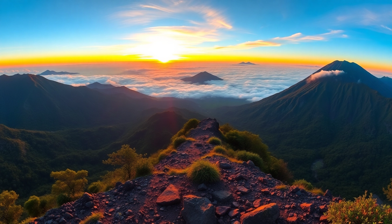
Standing at a height of approximately 3,726 meters (12,251 feet), Mt. Rinjani is relatively accessible compared to other high-altitude volcanoes globally, yet it remains challenging due to its rugged terrain and unpredictable weather conditions. Its summit offers panoramic views of the surrounding islands and the Indian Ocean on clear days, making it a rewarding destination despite the physical demands.
2.1 The Crater Lake – Segara Anak
The caldera hosts Segara Anak, a vibrant crater lake famed for its stunning turquoise color. This lake is not only a visual marvel but also an ecological hotspot, supporting various aquatic species and serving as a vital water source for the local communities and wildlife. Trekking around or relaxing by the lake provides a peaceful respite amidst the mountain’s formidable grandeur.
2.2 Volcanic Activity and Geology
Rinjani’s volcanic activity is characterized by periodic eruptions, with the most recent significant activity recorded in recent years. Its geological makeup includes layers of volcanic ash, lava flows, and pyroclastic deposits, which contribute to the soil fertility of Lombok’s surrounding areas. The volcano’s cone, or stratovolcano structure, is a classic example of volcanic evolution, with multiple vents and craters indicating past eruptions.
3. Cultural and Natural Importance
Rinjani is deeply embedded in the cultural fabric of Lombok. It is revered as a sacred mountain by local communities, often associated with spiritual rituals, offerings, and festivals. Many believe that Rinjani is a dwelling of ancestral spirits, and several traditional stories explain its origins and significance. For the Sasak and Lombok people, climbing Rinjani is more than an adventure; it’s a sacred pilgrimage that connects the physical and spiritual worlds.
Beyond its spiritual dimension, the mountain and its surrounding park are ecologically vital. The diverse flora and fauna, including endangered species like the Rinjani flycatcher and the Lombok pipistrelle, thrive in its dense forests, alpine meadows, and volcanic slopes. Conservation efforts aim to preserve this natural heritage, balancing tourism with ecological sustainability.
4. Planning Your Rinjani Trek
4.1 Best Seasons and Timing
Choosing the right time to undertake the Rinjani trek is crucial. The dry season, spanning from April to October, is considered optimal for trekking due to minimal rainfall, clearer skies, and more stable weather. The peak months—July to September—are particularly popular, but this also means higher demand for permits and guided tours. Conversely, the rainy season from November to March presents wetter conditions, increased risks of landslides, and muddy trails, making the climb more hazardous.
For safety and enjoyment, it’s recommended to plan your trek during the dry season and avoid the peak holiday periods if possible. Additionally, local weather patterns can change rapidly on the mountain; therefore, proper planning and flexibility are essential.
4.2 Required Permits and Regulations
Travelers must obtain permits to trek within Rinjani National Park, which is managed by Indonesian authorities. Permits often include park entry fees, climbing permits, and, in some cases, additional fees for camping or guided tours. It’s advisable to book through reputable local operators or park offices to ensure compliance with regulations.
Many regulations are in place to conserve the delicate ecosystem and ensure tourist safety. These include restrictions on camping areas, waste disposal, and fire management. Visitors should always adhere to leave-no-trace principles and respect local customs and sacred sites.
4.3 Essential Gear and Preparation Tips
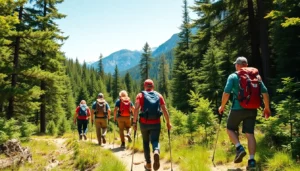
Preparing for Rinjani’s challenging terrain requires appropriate gear and physical readiness. Essential equipment includes durable hiking boots, layered clothing (for hot daytime and cold nights), rain gear, headlamps, trekking poles, and a good quality sleeping bag. Personal items such as suntan lotion, sufficient water, snacks, and a basic first aid kit are also vital.
Physical fitness is equally important. Engaging in cardio, strength training, and altitude acclimatization exercises weeks before your trek can significantly improve your experience. Hydration, proper nutrition, and mental preparedness also play crucial roles in overcoming the mountain’s physical demands.
5. Trekking Routes and Difficulty Levels
5.1 Sembalun Route Overview
The Sembalun route, starting from the village of Sembalun Lawang, is considered the most popular and relatively gentle path to the summit. Its gradual ascent passes through lush savannahs, volcanic craters, and rugged terrains, offering spectacular views of the surrounding landscape. The route spans roughly 27 km and typically takes 2-3 days to complete, depending on fitness and weather conditions.
Advantages of the Sembalun route include smoother trails, well-developed facilities, and scenic diversity. It’s suitable for trekkers with moderate experience who seek a well-rounded adventure with opportunities for acclimatization and sightseeing.
5.2 Senaru Route Overview
The Senaru route begins from the village of Senaru, leading through dense tropical rainforests, waterfalls, and traditional villages. While steeper and more challenging than Sembalun, it appeals to those seeking a more immersive experience in Lombok’s natural environment. The trek usually lasts 3-4 days and involves navigating rugged terrain, river crossings, and acclimatization to higher altitudes.
5.3 Choosing the Right Path for Your Experience
Deciding between routes depends on your physical condition, trekking experience, and sightseeing preferences. The Sembalun route is ideal for beginners or those with limited time, while the Senaru route offers a more adventurous and ecologically rich experience. Season and weather conditions should also influence your choice; always consult with local guides for current trail conditions and safety considerations.
6. Guided Tours and Local Support
6.1 Benefits of Hiring a Guide
While independent trekking is possible, hiring professional guides significantly enhances safety, navigation, and local cultural immersion. Guides possess expert knowledge of the terrain, weather patterns, emergency protocols, and the best spots for panoramic views and photos. Their presence reduces risks associated with altitude sickness, terrain hazards, and volcanic activity. Moreover, guides often assist with cultural explanations, facilitating respectful interactions with local communities and sacred sites.
6.2 Estimated Costs and Budgeting
The costs for guided expeditions vary based on duration, inclusions, and service quality. On average, a 3- to 4-day guided trek can cost between Rp. 5 million to Rp. 10 million (approximately USD 350–700), covering permits, guides, porters, meals, and accommodations. Additional expenses include tips and personal gear. Planning a budget with flexibility minimizes surprises and allows for comfortable, enjoyable experiences.
6.3 Tips for Selecting Reliable Operators
Selecting reputable tour operators involves checking credentials, reviews, and safety records. Look for guides certified by local authorities or trekking associations. Transparent pricing, clear itineraries, and positive customer feedback are indicators of quality service. Engaging with local communities or fellow travelers can provide valuable recommendations. Prioritize operators who emphasize eco-friendly practices and cultural sensitivity to ensure sustainable tourism.
7. Safety, Risks, and Conservation
7.1 Common Challenges During the Trek
Trekking Mt. Rinjani presents several challenges, including altitude sickness, unpredictable weather, physical exhaustion, and trail hazards such as loose volcanic rocks or steep descents. Proper acclimatization, pacing, and hydration are essential to mitigate health risks. Trekkers should also be prepared for sudden weather changes, including rains and cold nights, despite favorable forecasts.
7.2 Volcano Eruptions and Emergency Procedures
Although eruptions are infrequent, they can occur with little notice. Rinjani’s status is closely monitored by volcanological agencies, and permits often include safety instructions. In the event of increased activity, authorities may restrict access or evacuate areas. Visitors should stay informed via official channels and heed guides’ advice. Emergency preparedness entails carrying communication devices, knowing evacuation routes, and having basic first aid training.
7.3 Preserving the Rinjani Environment for Future Generations
Sustainable tourism practices are vital to preserving Rinjani’s ecological and cultural heritage. Visitors should minimize waste, avoid damaging flora and fauna, and support eco-friendly facilities. Participating in cleanup initiatives, respecting sacred sites, and supporting local communities economically foster conservation. As Rinjani continues to inspire awe and adventure, the collective responsibility of tourists, guides, and authorities will ensure this natural wonder remains pristine for generations to come.